


Researchers link the August 26 disaster to a massive ice-rock avalanche, warning that Nepal needs stronger early warnings, risk-informed planning and scientific coordination for Himalayan river corridors.
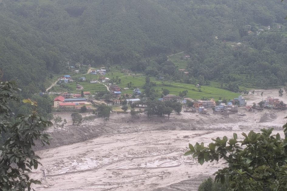
A catastrophic flash flood that struck Nepal’s Bhote Koshi-Trishuli river corridor on August 26 has caused widespread human, economic, infrastructural and environmental damage, according to a Rapid Situation Analysis Report prepared jointly by the Youth Alliance for Environment (YAE), Himalayan Cryosphere, Climate and Disaster Research Center (HiCCDRC), Kathmandu University (KU) and the Society for Conservation Biology Nepal.
The preliminary assessment indicates that the disaster was likely triggered by a massive ice-rock avalanche in the upper Lhende Khola catchment in the northern Himalayan region of Rasuwa. The event generated a high-energy flow containing ice, rocks, sediment, debris and water that rapidly moved downstream through the Bhote Koshi and Trishuli river systems.
A massive ice and rock avalanche triggered the disaster
The disaster initially raised speculation that a glacial lake or a supraglacial pond might have suddenly released a huge volume of water. However, analysis of available satellite imagery led researchers to a different preliminary conclusion: a massive ice avalanche from the glacier on the Nepal side of the Langtang-Lirung Himal was the underlying cause.
According to the report, a huge mass of ice, snow and rock fell from elevations between approximately 5,200 and 3,800 meters above sea level. The falling mass travelled rapidly downward, eroding additional ice, debris and material before reaching the Lhende River.
Researchers have conservatively estimated a collapse zone of about 2.26 square kilometers and an additional eroded area of approximately 2.93 square kilometers. Together, these areas may have mobilized more than 142 million cubic meters of ice, sediment, rock and debris, although field verification is still required.
The flood was exceptionally powerful. HEC-RAS analysis estimated a maximum flow velocity of around 15 meters per second, a maximum water depth of about 15 meters and a peak discharge of approximately 23,000 cubic meters per second at Syafrubesi.
Disaster unfolded within hours
The chain of events developed with extraordinary speed.
A major rock avalanche reportedly occurred at around 8:37 a.m. in the high mountain source area. By approximately 8:40 a.m., the resulting flood had begun moving downstream. At around 9:00 a.m., Nepal’s Department of Hydrology and Meteorology activated its early-warning system and issued high alerts along the Trishuli corridor.
Approximately 632,295 SMS alerts were reportedly sent through NTC and Ncell as authorities attempted to warn communities downstream.
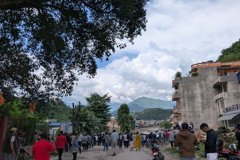
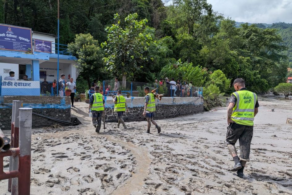
Between approximately 9:15 and 9:25 a.m., the flood entered areas including Timure, Syafrubesi, Betrawati, Trishuli, Bairab and Devighat. The Rasuwagadhi checkpoint was destroyed or severely affected, while aerial rescue operations were launched by the Nepal Army and private helicopters.
At around 10:30 a.m., the National Disaster Risk Council, chaired by the Prime Minister, convened to respond to the emergency. Six helicopters and drone teams were deployed, while free medical treatment was ordered for victims.
The flood continued moving downstream throughout the day.
From Rasuwa to the central and southern river corridors
The hardest-hit areas in Rasuwa included Timure, Rasuwagadhi, Syafrubesi, Hakubesi, Mailung, Shantibazaar, Betrawati, Trishuli Bazaar and Devighat. The flood pulse then travelled approximately 60 kilometers downstream, affecting areas of Nuwakot, Dhading, Gorkha, Chitwan, Tanahun and Nawalparasi.
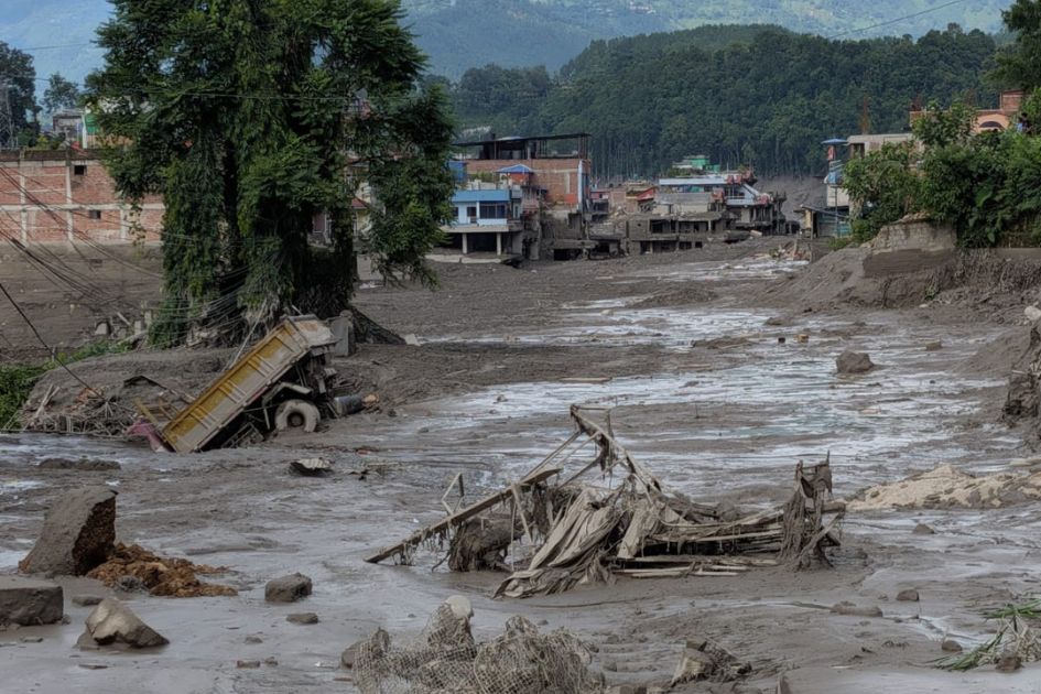
The disaster struck a major economic and transportation corridor. Roads, bridges, vehicles, settlements, hydropower infrastructure and border facilities were damaged or destroyed.
The Rasuwagadhi-Kerung cross-border trade route was also severely disrupted, affecting the movement of goods and people between Nepal and China. The disaster also disrupted electricity generation, tourism, transportation, businesses and local livelihoods.
Infrastructure damage estimated at NPR 200 billion
Preliminary estimates place direct physical infrastructure damage at approximately NPR 200 billion, while the government has estimated that reconstruction could require US$4-5 billion. The full economic impact, however, is expected to be considerably broader once damage to agriculture, livelihoods and other assets is fully assessed.
Approximately 40-45 kilometers of the Betrawati-Rasuwagadhi road were damaged or washed away. A total of 68 bridges, including 35 motorable bridges and 33 suspension bridges, were destroyed, according to the report.
Approximately 864 households in Timure, Syafrubesi, Rasuwagadhi and Betrawati suffered severe damage.
The energy sector also suffered major losses. Around 431.1 megawatts of electricity capacity, equivalent to roughly 10 percent of Nepal’s national grid capacity, was shut down. Fourteen hydropower projects with a combined capacity of approximately 748 MW were physically damaged. Six transmission lines were blocked, while the Trishuli 220kV 3B Hub Substation was completely destroyed.
Trade and tourism hit hard
The destruction of the Rasuwagadhi-Gyirong road cut off an important northern overland trade route with China. Timure customs facilities, vehicles and goods were damaged, further disrupting cross-border commerce.
Tourism was also affected. The closure of the Langtang trekking circuit initially cut off more than 519 foreign nationals from the rest of the country and had wider consequences for tourism-related businesses and supply chains.
Heavy human toll
The most devastating consequence of the flood has been the loss of human lives.
The report cites the latest National Disaster Risk Reduction and Management Authority figures available at the time, indicating approximately 1,050 confirmed deaths, around 3,946 people still out of contact and an estimated 93,000 people affected. Search, rescue and verification operations were continuing, meaning the figures could change.
The report also cites an NDRRMA update from August 29 recording 626 deaths and 2,426 people unaccounted for. The difference between the figures highlights the rapidly changing nature of the situation and the ongoing process of verification.
Behind the statistics are families facing profound grief and uncertainty. The death or disappearance of household heads and primary income earners is expected to create long-term emotional and economic difficulties for many affected families.
Schools destroyed, children displaced
The disaster also severely disrupted education.
According to the assessment, 18 schools were destroyed and another 20 were damaged, affecting an estimated 10,000 or more school-age children. For children who had already experienced the loss of homes, relatives and communities, the disruption of education added another layer of trauma.
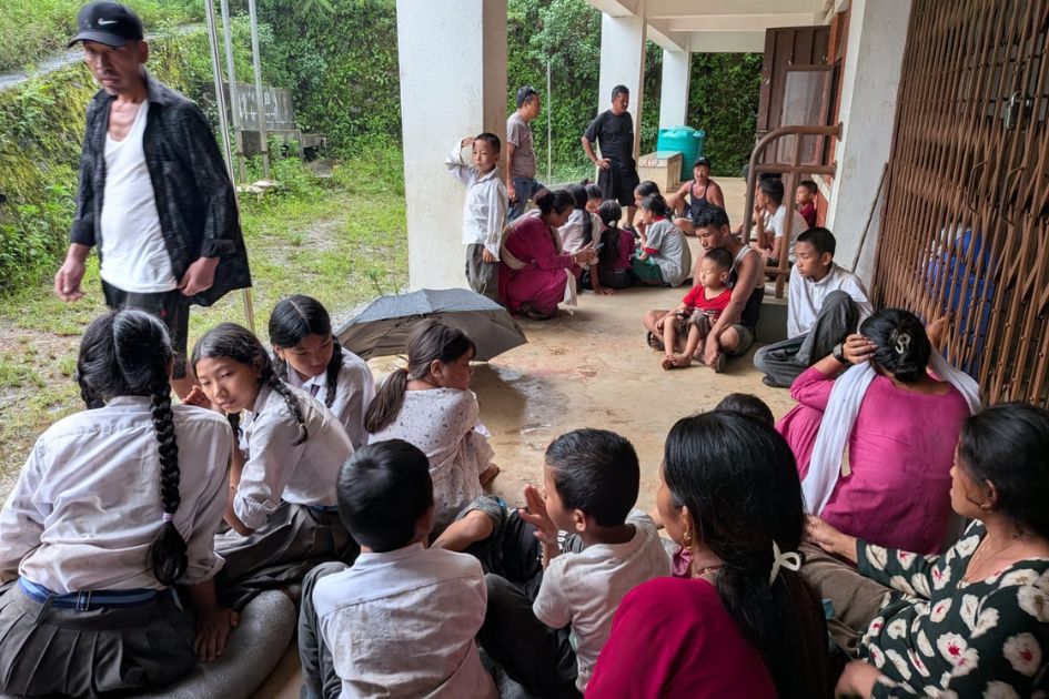
The report warns that survivors may experience grief, fear, anxiety and psychological trauma long after the flood itself has passed. Children are particularly vulnerable because many have simultaneously lost homes, family members, schools and their normal social environment.
Environmental damage remains unclear
The full environmental consequences of the catastrophe are not yet known.
A flood of this magnitude can severely affect river ecosystems, floodplains, vegetation and aquatic species. The report identifies the potentially serious impacts on species such as the globally endangered Golden Mahseer and the vulnerable Asala/Snow Trout.
Vegetation loss and destabilized riverbanks could also increase the risk of future erosion and landslides.
A warning for Nepal’s Himalayan future
The disaster has raised difficult questions about how Nepal anticipates and prepares for rapidly developing Himalayan hazards.
The report argues that rebuilding damaged infrastructure alone will not be enough. Nepal needs stronger scientific understanding of glacier-related hazards, better risk anticipation, more effective early-warning systems and stronger coordination among climate science, glaciology, geology, hydrology, meteorology and river sciences.
Early-warning systems are useful only when risks are properly understood, warnings reach people in danger in sufficient time and institutions and communities know exactly what action to take. The report therefore calls for stronger institutional mechanisms for risk anticipation and response, as well as risk-informed infrastructure and land-use planning.
The Bhote Koshi-Trishuli catastrophe has demonstrated the enormous destructive potential of cascading hazards in Nepal’s Himalayan river corridors. It has also highlighted the need to rethink how settlements, roads, hydropower projects and other infrastructure are planned in high-risk areas.
As search and rescue operations give way to recovery and reconstruction, the challenge facing Nepal will not simply be to rebuild what was destroyed. The larger challenge will be to rebuild more safely, using science, early warnings, risk-informed planning and stronger community preparedness to reduce the possibility of another disaster causing similar devastation.