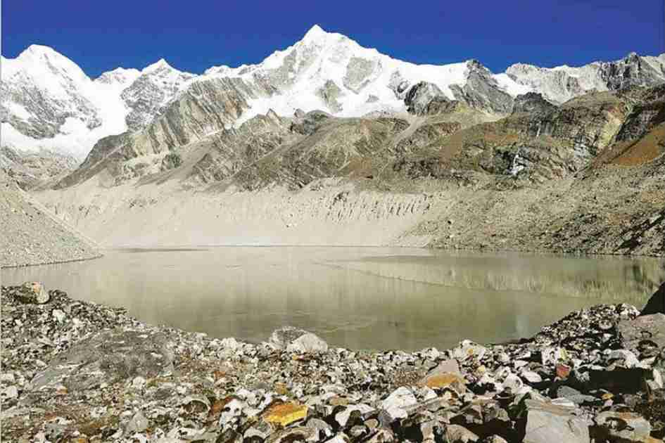



The automated observatory could help authorities detect hazardous lake expansion earlier, supporting disaster risk reduction, hydropower planning and protection of downstream communities as Himalayan glaciers retreat.
Glacier-fed lakes across Nepal and its transboundary river basins increased in both number and size from 2017 to 2024, with the fastest expansion recorded in the Koshi basin, according to the first automated annual inventory of Himalayan glacial lakes developed by scientists.
Published in the peer-reviewed journal Earth System Science Data, the dataset is expected to improve the monitoring of potentially dangerous glacial lakes and strengthen early warning efforts against glacial lake outburst floods or GLOFs, one of the fastest-growing climate-related hazards in the Himalayas.
Researchers from the University of Leeds, Kathmandu University, the Wadia Institute of Himalayan Geology and the Chinese Academy of Sciences developed the Glacial Lake Observatory, or GLO, which uses satellite imagery and artificial intelligence to automatically detect and monitor glacial lakes each year.
Previous inventories depended heavily on manual mapping and were generally updated only once every several years. The new system instead uses deep-learning algorithms trained on thousands of satellite images collected by the European Space Agency’s Sentinel-1 and Sentinel-2 missions.
The method allows researchers to track changes more frequently and consistently, including in remote mountain regions where cloud cover often restricts optical observations.
“Fully automated and systematic monitoring of lake area changes has been lacking,” the researchers wrote, adding that continuous observation is essential for detecting unusually rapid lake expansion, estimating water storage and understanding glacier-lake interactions under a warming climate.
The study identified 4,150 unique glacial lakes using Sentinel-2 imagery and 2,967 lakes through Sentinel-1 radar observations across Nepal and neighbouring catchments in India and China.
Researchers mapped more than 22,000 individual lake outlines using Sentinel-2 imagery and more than 18,000 outlines from Sentinel-1 data collected between 2017 and 2024.
The combined dataset found that glacial lakes covered an average annual area of about 169 square kilometres. Both the number of lakes and their total area increased during the eight-year study period.
The Koshi River basin accounted for most of the expansion and contains about 61 percent of all mapped glacial lakes. Nine of the 10 fastest-expanding lakes identified by the study are within the basin, highlighting its growing vulnerability.
Researchers found that the expansion was concentrated mainly in high-elevation, glacier-fed lakes receiving meltwater directly from retreating glaciers.
The findings come as scientists warn that glaciers across the Hindu Kush Himalaya are melting at unprecedented rates, with regional temperatures rising much faster than the global average.
The paper said High Mountain Asia, often known as the “Third Pole” because it contains the world’s largest concentration of ice outside the Arctic and Antarctic, is warming at about twice the global average.
As glaciers lose mass, meltwater collects behind unstable moraine dams, forming and enlarging glacial lakes. Although the lakes temporarily store freshwater, they can fail catastrophically when triggered by avalanches, landslides or collapsing ice, releasing millions of cubic metres of water downstream within hours.
Glacial lake outburst floods have repeatedly damaged settlements, hydropower plants, roads and bridges in Nepal and neighbouring Himalayan countries.
The researchers warned that continued glacier retreat could increase both the number and size of hazardous lakes unless they are systematically monitored.
The research team developed the observatory by training a deep-learning model known as DeepLabV3 on manually mapped glacial lakes before applying it to satellite imagery covering the 2017-2024 period.
The system analyses radar and optical satellite images separately before combining the results.
Sentinel-1 radar imagery makes monitoring possible under cloudy conditions, while Sentinel-2’s higher-resolution optical imagery detects smaller lakes more accurately.
Validation showed that the automated mapping performed strongly, with F1 scores ranging from 0.80 to 0.92. Sentinel-2 consistently detected small lakes more effectively than radar imagery.
Researchers said using the two satellite systems together helped overcome one of the main obstacles to monitoring the Himalayas: persistent cloud cover during the monsoon.
The newly published dataset is openly available and will underpin a continuously updated Glacial Lake Observatory portal that is under development.
Scientists expect the database to support disaster risk reduction, glacier research, climate studies, hydropower planning and water resource management.
Because the process is fully automated, future updates can be produced regularly without requiring large teams to manually map thousands of lake boundaries.
“This provides the foundation for systematic glacial lake monitoring that does not require manual intervention,” the authors said.
Nepal has experienced several destructive glacial lake outburst floods in recent decades, while earlier studies have already identified dozens of potentially dangerous glacial lakes.
Scientists said continuous monitoring has become increasingly important for protecting downstream communities and critical infrastructure as climate change accelerates glacier retreat across the Himalayas.
The new observatory could also help authorities detect unusual lake expansion earlier, allowing more timely field investigations and risk assessments before catastrophic failures occur.
Researchers said the annual dataset marked only the first phase of the Glacial Lake Observatory. Future releases are expected to continue tracking changes in Himalayan glacial lakes as climate warming reshapes one of the world’s most sensitive mountain environments.