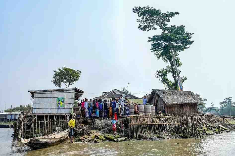



Six decades after transforming coastal farming, Bangladesh’s polders are facing a sediment crisis that leaves communities dependent on walls, drainage and difficult choices.
After Cyclone Remal made landfall near the Bangladesh-India border in May 2024, tidal surges breached polders across Khulna, Bagerhat, Satkhira, Barguna and Patuakhali within hours. An estimated 3.75 million people across 19 districts were affected. The government sent relief. Engineers were dispatched. And the cycle that has repeated itself after every Sidr, every Aila, every Amphan, began again.
Official post-disaster reports tend to emphasize damage and repair more than the geomorphic reasons embankments fail. In measurable terms, they also altered flood dynamics in ways that made some problems worse. This is the central paradox of Bangladesh’s coastal polder system, and it has been accumulating quietly for sixty years.
Beginning in the 1960s under the Coastal Embankment Project, 139 polders were built across 1.2 million hectares of the Ganges-Brahmaputra-Meghna delta. The engineering logic was straightforward: walls of compacted earth would hold tidal water out and keep saline intrusion away from agricultural land. For a nation facing recurring coastal disasters, the polders were a serious and necessary intervention. At least eight million coastal residents were identified as highly vulnerable to cyclones and storm surges, and polders were seen as essential protection for them. They made large-scale agriculture possible in the delta.
Under natural delta conditions, tidal rivers deposit silt on surrounding floodplains twice daily. This sediment accumulation is how the delta keeps pace with a gradually rising sea. When embankments sever the connection between river and floodplain, that exchange stops. The land compacts under its own weight, with nothing arriving to replace what is lost. A 2019 study in Science of the Total Environment by Adnan, Haque and Hall, which modelled flood patterns across south-western Bangladesh between 1988 and 2012, found that polder interiors had sunk so significantly that ordinary monsoon rainfall, not cyclone surges, just rain, now had nowhere to go. On average, the polders had increased the area affected by this internal flooding by 6.5 per cent, or 334 square kilometers. The embankments were contributing to the flooding of the communities they were built to protect.
Field observations by coastal geologist Steve Goodbred and colleagues showed what this looked like on the ground after Cyclone Aila in 2009: land inside Polder 32 had fallen to more than a meter below average high tide. The polder had become a basin. When the walls broke, the water arrived all at once and stayed.
The same study by Adnan, Haque and Hall modelled what happened during Cyclone Sidr in 2007. In reality, breaches in several embankments, combined with pluvial inundation, left about 35 per cent of the coastal area flooded. The model estimated that had those embankments remained intact, inundation would have been limited to around 18 per cent. The findings illustrate a dual reality: embankments can substantially reduce storm-surge flooding when they hold, but once they fail, years of subsidence and impaired drainage can trap floodwater inside the polders, prolonging inundation.
Corruption and negligence have undeniably weakened embankment projects, but they do not fully explain why polders keep failing; long-term geomorphic change, sediment deprivation, and drainage impairment are also central.
A perfectly executed polder programme, with zero graft and complete transparency, would still leave millions of people living on sinking land below the high-tide mark, entirely dependent on structures that cannot keep pace with subsidence or sea-level rise. The corruption critique addresses how the embankments are built. It says nothing about what they do to the land.
A 2025 study published in One Earth added a further dimension: rising riverbeds, caused by the same interrupted sedimentation that is sinking polder interiors, are increasing structural stress on embankments even from low-intensity cyclones. The walls are being squeezed from both sides simultaneously. The World Bank committed $400 million in 2013 to raise embankments across 17 polders. The investment addressed neither the subsidence inside nor the disrupted sediment dynamics outside. Raising walls higher on land that is simultaneously sinking is a response that must be repeated indefinitely, at increasing cost, with diminishing returns.
Research on coastal Bangladesh shows that shrimp aquaculture expanded in embanked areas and created strong externalities for paddy farming, while salinity intrusion and land-use change have constrained conventional agriculture in many coastal zones. In practice, the polders built to keep saltwater out also reshaped coastal water management in ways that often made saline land use more attractive and traditional rice cultivation harder to sustain.
Tidal River Management (TRM) works by controlled flooding through dike breaches, restoring tidal exchange so sediment can enter the polder and rebuild land elevation. Sediment re-deposits on the sinking interior. Land elevation recovers. The process takes years and it is genuinely disruptive: fields remain inundated during the sedimentation phase, and communities must be compensated and supported through the transition. In some TRM sites, residents endured years of inundation while the land rebuilt itself beneath them. The complaints were real. The land recovery was also real.
This is not a proposal to remove embankments. The 2019 study was precise on this point: polders provide genuine protection against moderate storm surges and river flooding. The problem is not the embankment as a concept. It is a one-size-fits-all embankment strategy applied across very different coastal settings without enough site-specific differentiation or room for managed tidal exchange where that would work better.
The Sundarbans, meanwhile, is doing work that no embankment can replicate. Research following Cyclone Sidr confirmed that communities behind intact mangrove belts experienced measurably lower surge heights. One of the most cost-effective elements of any serious coastal protection strategy is the restoration of salt-tolerant mangrove buffer on the seaward face of existing embankments. It is not supplementary to coastal engineering. It is the part that absorbs what the engineering cannot.
When the next cyclone comes, the question will not be how quickly the walls can be rebuilt. Bangladesh has become efficient at that part. The question is whether the embankment being rebuilt is the right kind, in the right place, designed in consultation with the people who can tell an engineer which bend hits hardest at spring tide and which stretch was already failing three monsoons before anyone filed a report.
The writer is an environmental writer focused on climate change and climate justice in Bangladesh. He is a student at Begum Rokeya University, Rangpur.