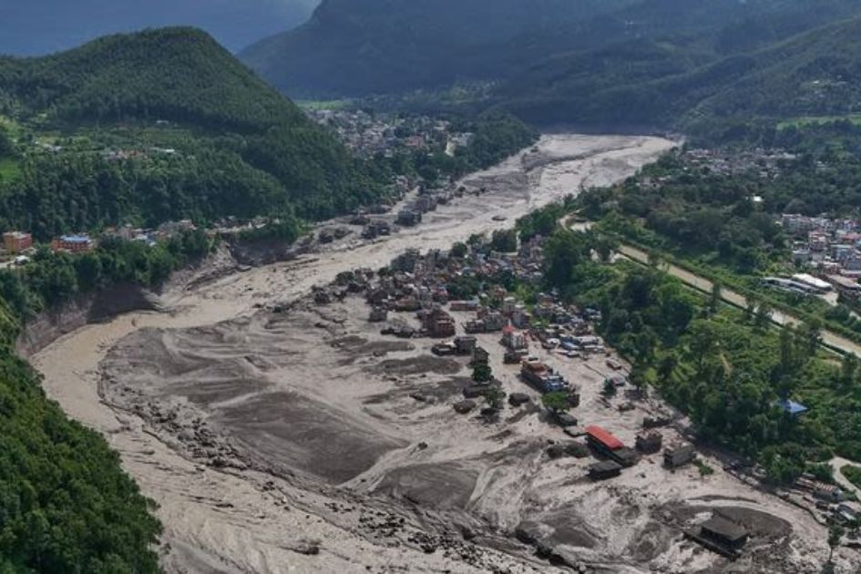



Satellite evidence points to a high-altitude snow and rock collapse near Langtang Himal, with experts warning that rapid ice melt may have intensified the downstream destruction.
Officials have confirmed that an avalanche in the northern Langtang Himal caused the flooding in the Bhotekoshi River, which flows along Nepal’s border with China. Yesterday morning, a devastating flood occurred in Nepal. 157 people have been confirmed to have lost their lives so far. As of now, Preliminary reports indicate that more than 500 people are missing, and the number is expected to rise.
According to Nepal’s National Disaster Risk Reduction & Management Authority, citing data from Planet Labs, a large mass of snow and debris appears to have fallen after a section of the glacier on the northern side of Langtang Himal detached, dropping from an elevation of nearly 5,000 meters to the river surface at around 3,000 meters.
A preliminary analysis based on satellite imagery indicates that a massive snow-and-rock landslide occurred about 20 kilometers northeast of the Rasuwagadhi border crossing along the Nepal-China border. The landslide triggered a debris-laden flood in the Lhende Khola, which then flowed through Timure and entered the Trishuli River. The landslide site lies on the Nepalese side of the border.
Hydrologist and climate expert Santosh Nepal says that, based on the volume of water that reached the downstream areas of the Bhotekoshi River, the disaster may not have been caused solely by the release of water temporarily blocked by the river.
“Considering the volume of water that flowed through the downstream areas, this event may not have been limited to the release of water that was temporarily blocked in the Bhotekoshi River,” says senior hydrologist and climate expert Santosh Nepal. “The energy generated by the falling snow and ice may have caused rapid melting of additional snow and ice. The combined effects of these processes could partly explain the unprecedented destruction observed in the downstream areas.”
From the Rasuwagadhi border area to the Narayani Bridge in Narayanghat, the floodwater covered a distance of approximately 350 kilometers in about seven hours-from around 9 a.m. at Rasuwagadhi to 4 p.m. at the Narayanghat bridge. This suggests an average flow speed of roughly 40 kilometers per hour.
Nepal says the current analysis is based on limited data and information available so far. As more information becomes available in the coming days, a more precise understanding of the causes and processes behind the disaster is expected to emerge.
The Prithvi Highway, the main road connecting the affected region with Nepal’s capital, Kathmandu, has been closed indefinitely. Large amounts of mud and debris have accumulated along several sections of the highway.